

Suggestions - Archive
231 topics in this forum
-

Similar to Volanta, is it possible to add a progress bar along maybe the bottom of the overlay?
-
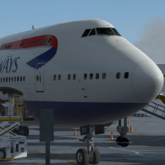
Nice to see that Elevatex can track screenshots now. However, in ShareX, I have it set up to start a new folder everyday for easier screenshot organisation. So for example, my set up is "H:\ShareX Screenshots\that day's screenshots", the last folder following a name format of yyyy-mm-dd. I'm sure I'm probably not the only person who has some screenshot organisation like this, so it'd be beneficial to just set the screenshot directory as the top folder, in my case "ShareX Screenshots", and then it can check any subfolders too. Cause as of right now, it doesn't seem to do this, which'd mean having to set up a new directory every day which isn't very user friendly.
-

When flying with a custom time set in game and in simbrief, the OFF and ON ground times shown in the flight status on the top left are largely irrelevant, as they're based off real time. For example, if I set the departure time in simbrief as 1200Z when it's 1700Z real time, Elevatex expects the OFF ground time to be ~5hr ago, when in reality it'll likely be in ~30m or so. It also shows "delayed by xx time" in a really ugly red color :( It would be nice to have the option to override the simbrief OFF ground time, so that the times shown in the flight status are more relevant to the flight. The ON ground time could then be calculated simply by adding the flight time from t…
-

Hello. I suggest kind of simple feature. AFAIK, the landing rate popup appear to observers only when use streaming features. But I want to see it at my simulator regardless of streaming. I mean just popup shortly on my display. That's all. Many simmers want to see their landing rate scores. So if the feature will release, i may sooo helpful. Please considor about that! thank you!
-
- 1 reply
- 486 views
- 1 follower
-
-

Hello, as the title says, it would be great to be able to sort aircrafts by airline, like the new "sort by ICAO" feature you added, but with the airlines. Best regards
-

Similar to flightradar24, it'd be nice to have a draggable progress bar which you can use to see certain information at a given time- location of aircraft, ground speed, altitude.
-

Goal: Connect IVAO data to Elevatex to display live flights and ATC activity directly in the app. Features: Display of active IVAO pilots and controllers (live status) Push notifications when selected ATC stations (e.g., EDDF_TWR) come online Link personal IVAO account (ratings, planned flights) Overview of upcoming IVAO events Technical Basis: Uses the public IVAO Webeye API (JSON format) Added Value: More relevance for IVAO users, improved flight planning, central hub for virtual aviation info.
-
- 1 reply
- 608 views
- 1 follower
-
-

I think the aircraft and the chart should be reworked. My alt is 17000 and its still showing me as on ground and during cruise it will start descent itself. Maybe the line should start going up when it detects wheels up, flatline when it detects no climb/descent and go down when it detects a high negative V/S.
-

If it would be possible to add Sayintentions traffic to the map with a on/off toggle button would be awesome :)
-

A tool (preferably in the toolbox) where you can see the scheduled and actual OOOI times in Z for time planning purposes. Should also be visible after completed flight. Maybe even color marking for even better user experience. Ex. Scheduled Actual OUT 1440 1438 OFF 1450 1447 ON 1710 1701 IN 1715 1712
-
- 1 reply
- 464 views
- 1 follower
-
-

Hi! It would be great if we could import data from Simtoolkit pro in addition to volanta
-

For those using time acceleration, ability to show the flight time in the sim instead of real flight time for the logbook.
-

Example: Let's say I am doing a 5hr flight and I take a few screenshots in the first few hours. Let's say I don't immediately add the screenshots but later I get around to it. Currently, the screenshots would be added to where I currently am on the map, however, it would be better to add the screenshots to the map in the location I was at the time I took them.
-

Hey, i was wondering if there a possibility to include to darker mode like how OLED screens work, completely black compared to the gray dark one currently exists, thanks!
-
- 1 reply
- 505 views
- 1 follower
-
-

1 - the option to have a combined type hours counter instead of them calculating per registration example - I have 750 flight hours on 747, I don't want those hours split between several registrations and have to calculate total hours manually - maybe a cascading aircraft list that goes by type first then can be dropped down into reg thereafter - removes clutter and duplicated types as i'd prefer not to have hundreds of aircraft 2 - the ability to change saved aircraft registration - example - I can tell the flight that I'm using reg - N355UP and it'll all log to the same aircraft but I can then never change that saved aircrafts Reg - …
-

Having some form of GPS spoofing map similar to how FR24 has it would be nice. Could be helpfulTM for the ini a350 users and would be nice to see nontheless
-
I absolutely love the Discord activity the Elevatex shows and how it cycles through the info, however, it is missing one key feature - the aircraft! It is amazing to have all the info show on discord, but I feel the aircraft is the main part of the entire trip, and as such, should also be displayed so people know what plane you're flying.
-

I would really appreciate the addition of an airport symbol on the map for all the in game airports. I like to do some VFR flying and using ElevateX as my GPS map. Instead I have to open something like littlenavmap on the side to see where other airports are that I can access. They're just not visible on the map currently. Why not have zoom levels showing major and then minor airports the closer you get? The runways and taxiways are currently on the map already. Could be a toggle for the icon to minimize clutter.
-
Wondering what the issue is with weather radar constantly being totally innaccurate and if there is a way to fix this/pull from the sim? Attached a screenshot from weather.com with accurate precipitation that was in the sim in live weather. ElevateX attached as well which is completely out of sync. Mostly came to my attention as I was flying the Aleutians which almost always had some kind of weather that ElevateX never showed on the map. Hoping we can get better info in the future.
-

Hello Dev team, I wanted to make a suggestion that elevatex would be nice to have on MacOS/IpadOS. I do know a little bit of Xcode and I haven't played around with it in a while however I am willing to relearn it if the Devs of elevatex want to make this possible. For now if it posses too much of a cost to fully code with Xcode I would suggest that the devs look into piggie backing off of navigraph just like how they made chart's for IOS devices. I do have a mac and I'm willing to help out this wonderful platforme by eirther deving it or testing it.
-

In VATSIM, it is common practice for ATC to extend themselves to control multiple sectors at the centre level. Currently, Elevatex only shows the primary sector and doesn't display any information of extended sectors. It would be more accurate to allow interpret and display the extended sectors. You can reference the CTR controllers at Australia and NZ who are very commonly controlling more than one sector at a time.
-
Hello! It would be nice to have the ability to quickly enable or disable the dark mode when we are reviewing a landing. Let me explain, I prefer the dark mode when viewing the map with all my flights, as the lines are more visible. But when reviewing a landing I prefer disabling it in order to check if I landed within the limits, thanks to the satellite imagery. Currently we have to go back to the main map page in order to enable or disable it, having a quick toggle in the upper right corner for example would be nice, or we could even in the settings choose to automatically switch off the dark mode when reviewing a specific flight. I ho…
-

When I imported my data from Volanta I got back all the flights I previously deleted and it would be nice to have a function to just select all the flights you want to delete and then delete them all together.
-

It would be nice if you can populate the departing gate and arrival gate from the ACFT position (or maybe from a real source even if it's a bit more complicated probably)
-
It would be fantastic to have more map filter options. I'm sure people can suggest others. Personally I like to know where I am so it would be very useful if you could turn on place names on the map and possibly even airports. In the case of airports, I think a must is having your departure/arrival airports visible. Its awkward pressing 'show full route' and seeing just a blank map of the world as I don't want to have the filed route visible.